24 hours on Reinhaugen
Reinhaugen June 27th / 656.2 moh / 68.943701º N – 017.848770º E
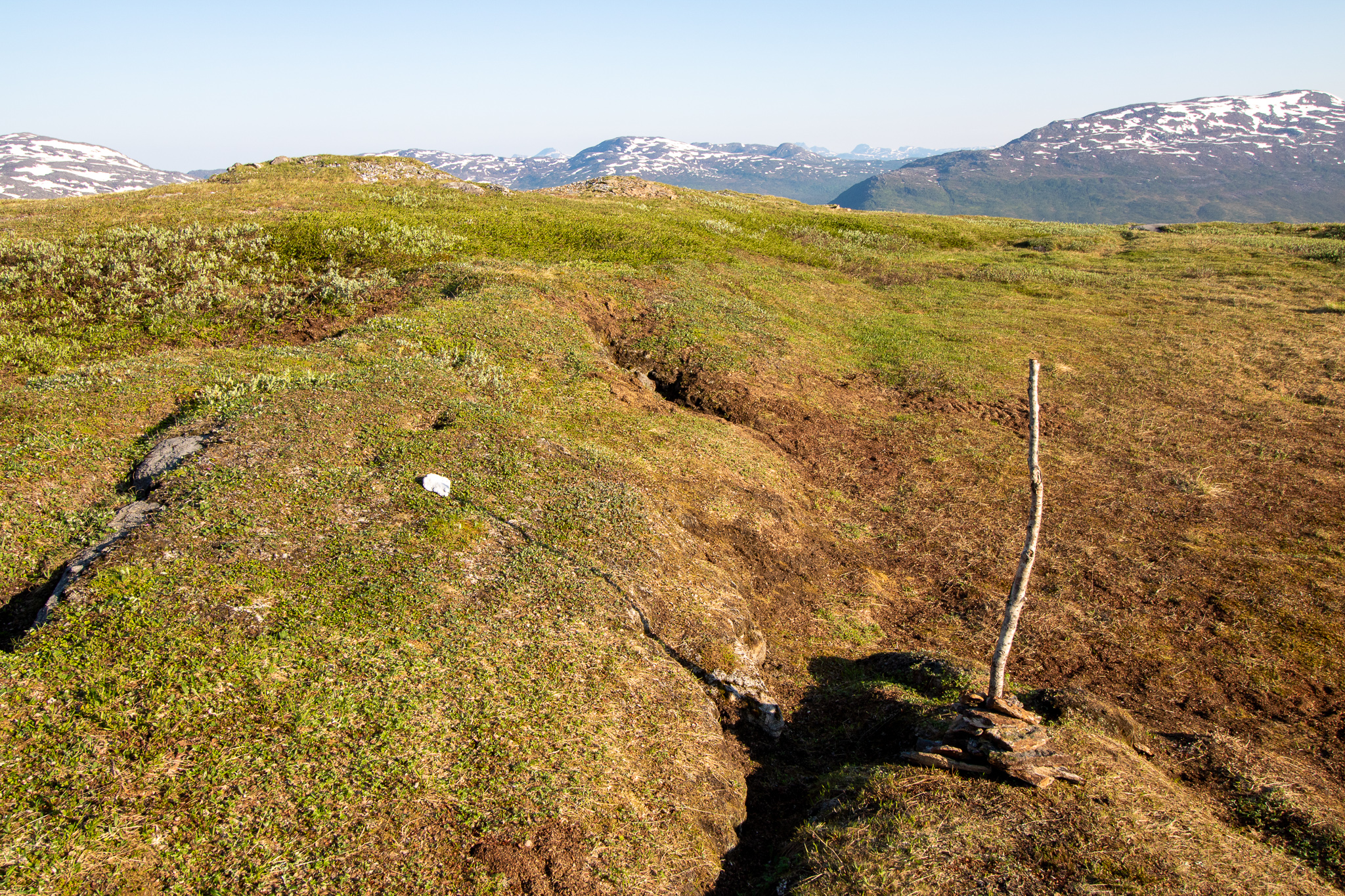
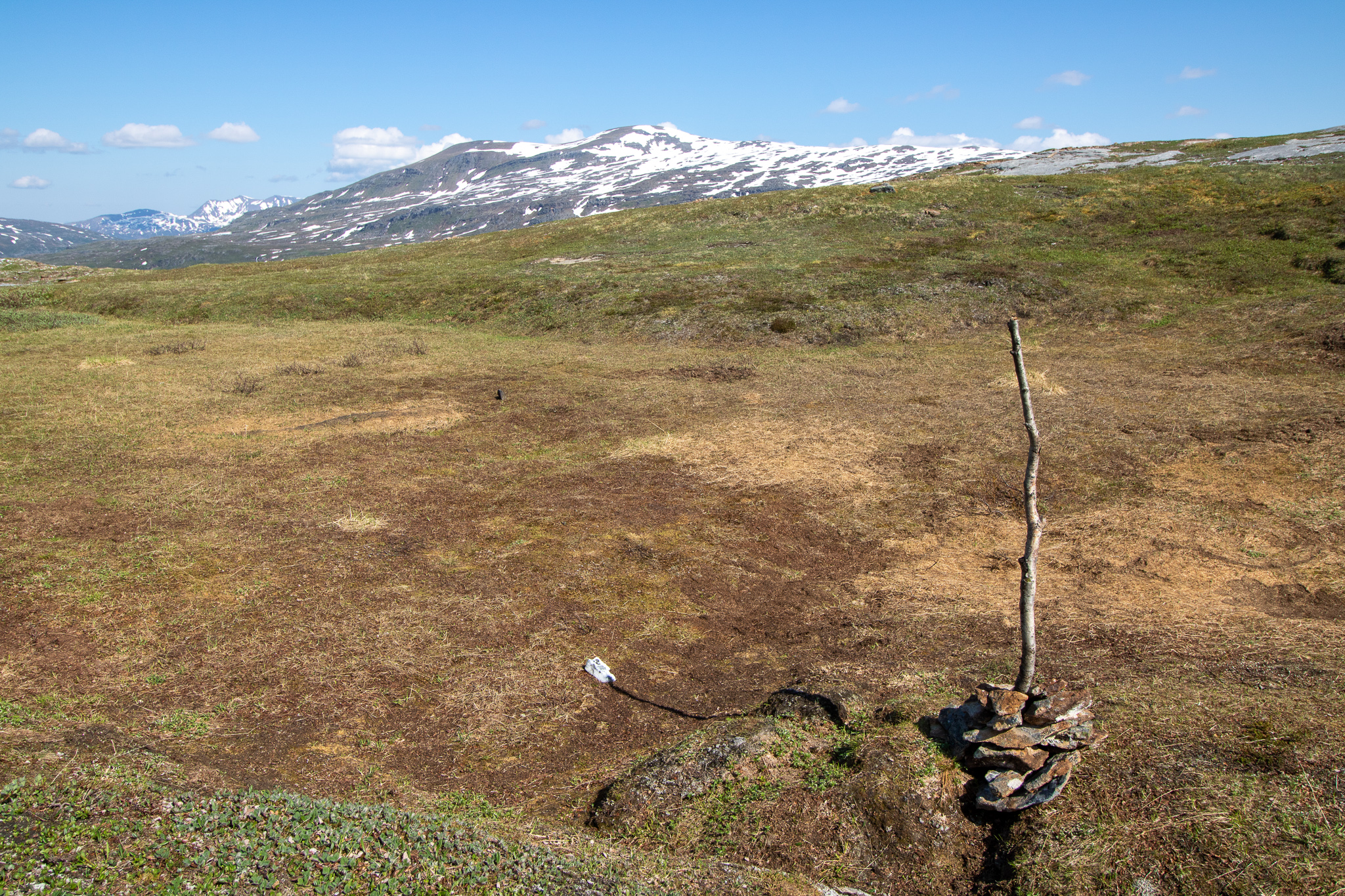
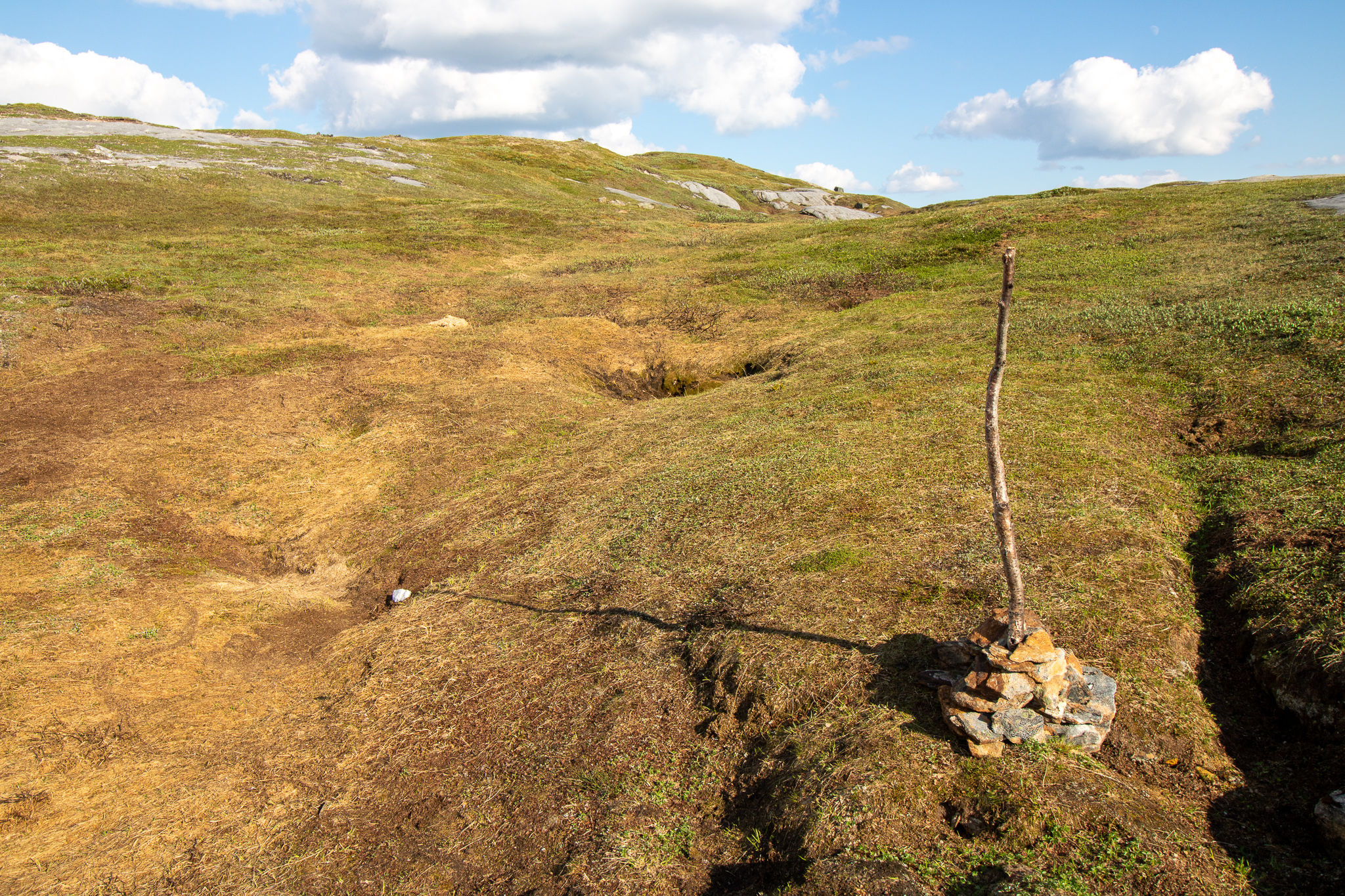
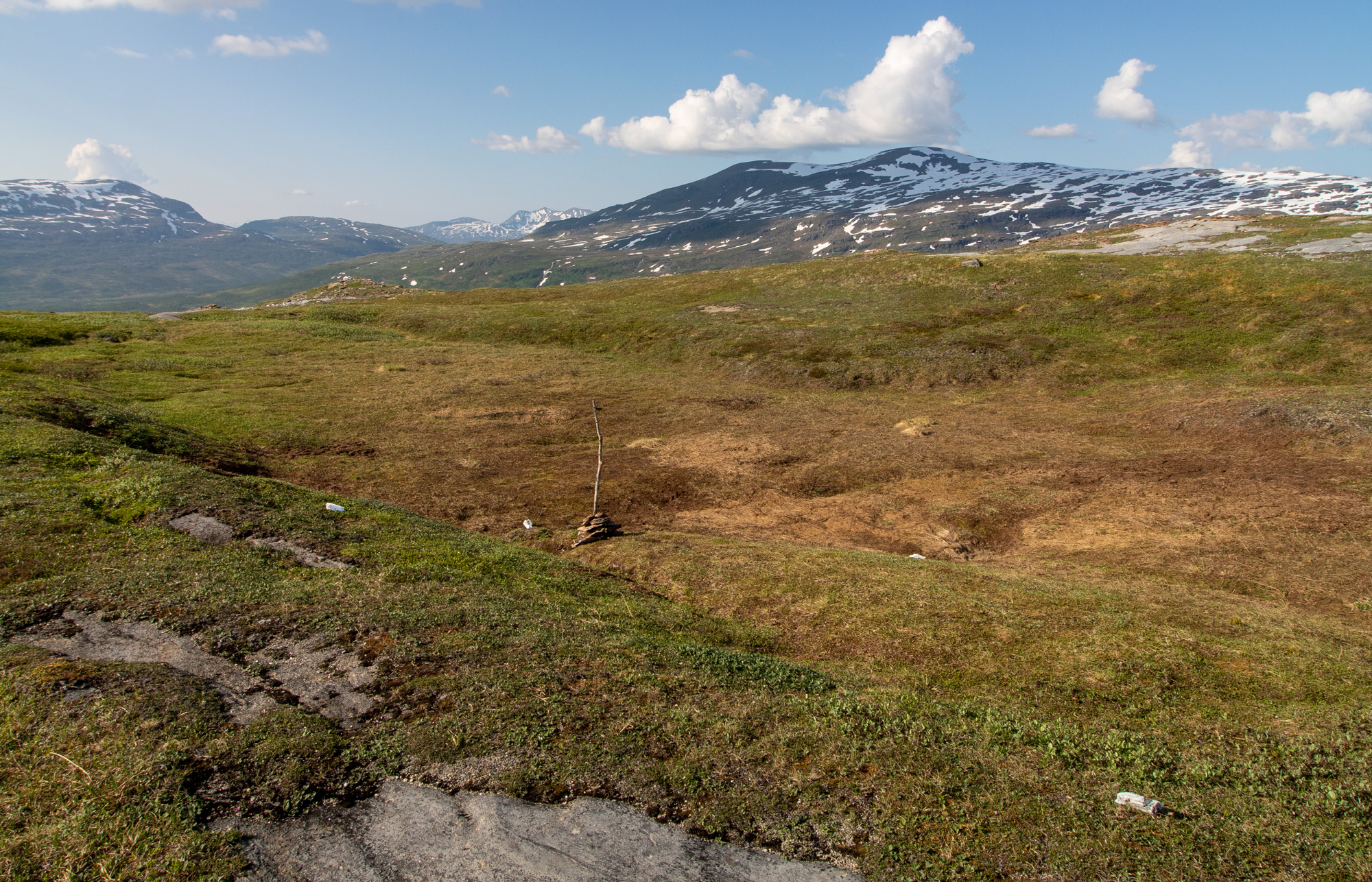
It was a sunny day on June 26th when I walked up to Storhaugen for a two-day exploration and camping trip at Salangsverket mine and its surrounding area. I set up base camp on the foot of Reinhaugen from where I initiated my first project. I walked up to the Northern side of the top of Reinhaugen before midnight, where I erected a found wooden stick with the use of some stones. At exactly midnight I marked the end of the shadow that was cast by the stick with a white albite stone which I also found on top of the mountain. Every six hours I returned to the same spot and marked the shadow at those times. I documented each moment with a photograph.

60 by 90 cm framed in walnut with ultraview UV70 reflex free glass

00.00h
06.00h
12.00h
18.00h
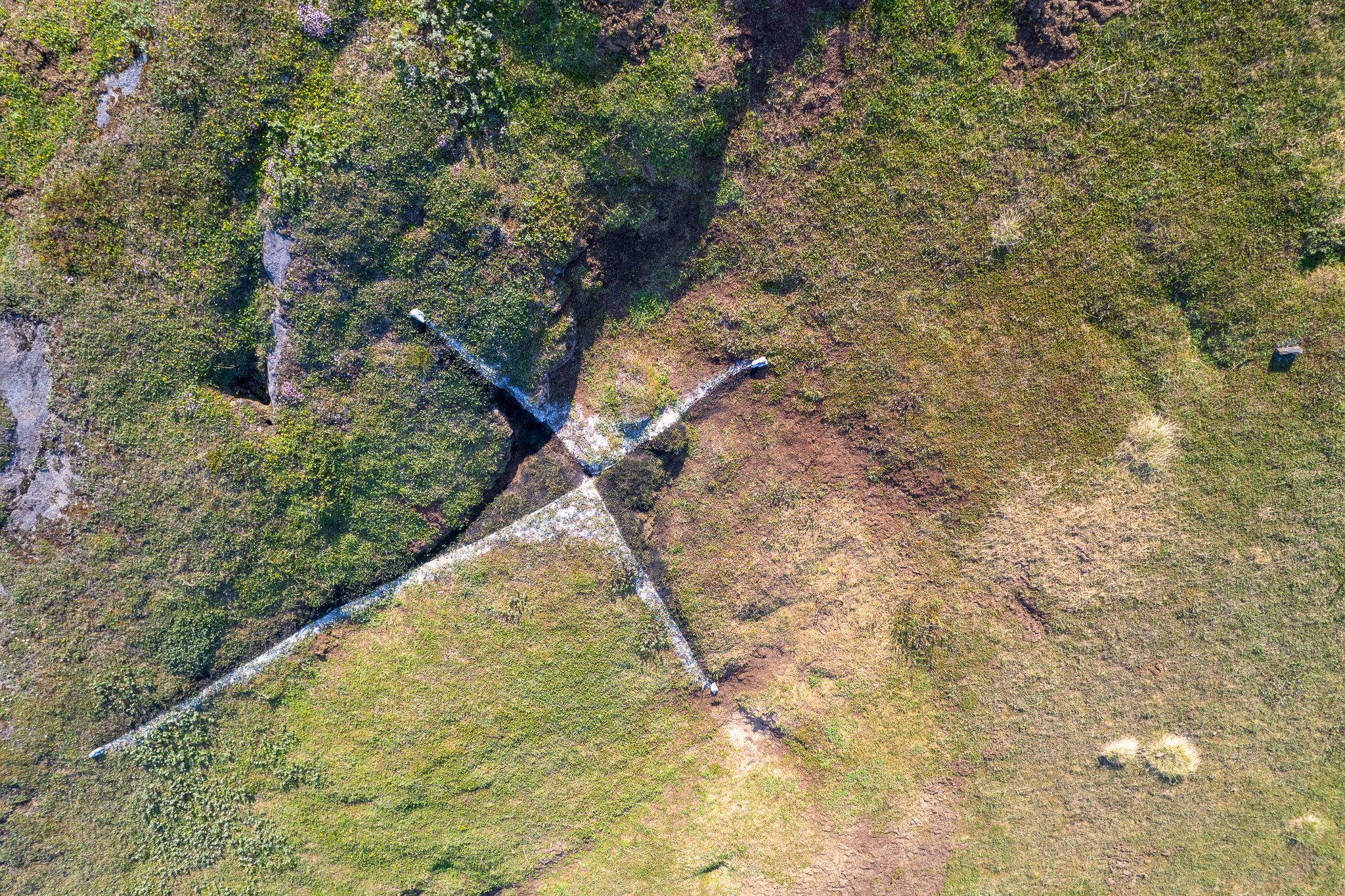
The end result was a crossed shape, marked by the four white albite stones and the erected stick in the middle. I indicated the Northern direction by putting a dark grey stone containing a lot of iron a bit outside the four markings. The position of the rock and its response to magnetism relates to the earths geomagnetic field which makes a compass point to the northern direction.
Four days later I returned to the same place, removed the stick and marked the four shadow lines with calcium powder and charcoal powder.
This first marking of me being on the mountain and connecting to the place and time has disappeared after a couple of rain showers, leaving only the five stones in place, probably never to be noticed again by anybody.